


WEATHER NEWS FOR MAURITIUS ISSUED AT 16H30 THIS THURSDAY 14 APRIL 2016.
GENERAL SITUATION:
A. A strong wind warning is in force in Mauritius.
B. Clouds coming from the south-east are influencing the local weather.
FORECAST FOR THE NEXT 24 HOURS:
Cloudy periods at night with passing showers more frequent over the central plateau, to the east and south.
Fog patches will be prequent in certain regions.
The minimum temperature will be about 21 over the central plateau and 23 to 26 degrees Celsius along the coastal regions.
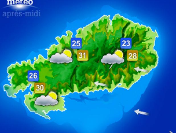
There will be cloudy periods tomorrow with showers more frequent over the central plateau, the eastern and southern slopes.
The maximum temperature will be 23 to 26 degrees Celsius over the central plateau and 28 to 31 degrees Celsius elsewhere.
Wind will blow from the south-east 35 to 45 km/h with gusts reaching 80 to 90 km/h in exposed areas.
Sea rough beyond the reefs with swells.
The public is strongly advised not to venture at sea.
Some useful advices:
(1) The public is advised to be careful to flying objects, cross winds on the roads and while manoeuvering on tall structures.
(2) Visibility will be reduced due to fog patches and in showers, it is advised to be cautious on the roads.
Supplementary Information:
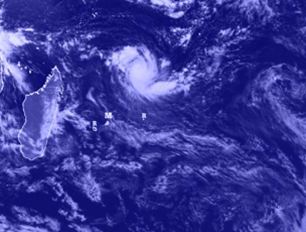
At 16h00 the tropical cyclone ' FANTALA ' was centered around the point 12.4 degrees south in latitude and 62.5 degrees east in longitude that is at about 950 km to the north north east of Mauritius.
It is moving in a general westerly direction at about 15 km/h.
High Tides: 22h06 and tomorrow 09h36.
Low Tides: Tomorrow 04h04 and 16h12.
Sunrise : 06h21.
Sunset : 17h58.
The atmospheric pressure at 16h00: 1015 hectoPascals.